


Newport P-2, Washington County, Minnesota
About
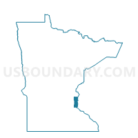
Outline

Summary
| Unique Area Identifier | 604803 |
| Name | Newport P-2 |
| County | Washington County |
| State | Minnesota |
| Area (square miles) | 2.29 |
| Land Area (square miles) | 2.22 |
| Water Area (square miles) | 0.07 |
| % of Land Area | 96.87 |
| % of Water Area | 3.13 |
| Latitude of the Internal Point | 44.88245910 |
| Longtitude of the Internal Point | -92.99301500 |
Maps


Graphs
Select a template below for downloading or customizing gragh for Newport P-2, Washington County, Minnesota


Neighbors
Neighoring Voting District (by Name) Neighboring Voting District on the Map
- Maplewood P-16, Ramsey County, MN
- Newport P-1, Washington County, MN
- South St. Paul P-4 W-2, Dakota County, MN
- South St. Paul P-5 W-3, Dakota County, MN
- St. Paul W-7 P-15, Ramsey County, MN
- St. Paul W-7 P-5, Ramsey County, MN
- Woodbury P-13, Washington County, MN
- Woodbury P-6, Washington County, MN
Top 10 Neighboring County Subdivision (by Population) Neighboring County Subdivision on the Map
- St. Paul city, Ramsey County, MN (285,068)
- Woodbury city, Washington County, MN (61,961)
- Maplewood city, Ramsey County, MN (38,018)
- South St. Paul city, Dakota County, MN (20,160)
- Newport city, Washington County, MN (3,435)
Top 10 Neighboring Place (by Population) Neighboring Place on the Map
- St. Paul city, MN (285,068)
- Woodbury city, MN (61,961)
- Maplewood city, MN (38,018)
- South St. Paul city, MN (20,160)
- Newport city, MN (3,435)
Top 10 Neighboring Unified School District (by Population) Neighboring Unified School District on the Map
- St. Paul Public School District, MN (285,068)
- South Washington County School District, MN (92,998)
- North St. Paul-Maplewood School District, MN (76,855)
- South St. Paul Public School District, MN (20,001)
Top 10 Neighboring State Legislative District Lower Chamber (by Population) Neighboring State Legislative District Lower Chamber on the Map
- State House District 56B, MN (49,803)
- State House District 57A, MN (40,488)
- State House District 55B, MN (38,632)
- State House District 67B, MN (35,739)
Top 10 Neighboring State Legislative District Upper Chamber (by Population) Neighboring State Legislative District Upper Chamber on the Map
- State Senate District 56, MN (91,226)
- State Senate District 57, MN (81,647)
- State Senate District 55, MN (76,856)
- State Senate District 67, MN (72,594)
Top 10 Neighboring 111th Congressional District (by Population) Neighboring 111th Congressional District on the Map
- Congressional District 6, MN (759,478)
- Congressional District 2, MN (732,515)
- Congressional District 4, MN (614,624)
Top 10 Neighboring Census Tract (by Population) Neighboring Census Tract on the Map
- Census Tract 710.18, Washington County, MN (12,597)
- Census Tract 374.03, Ramsey County, MN (6,285)
- Census Tract 710.12, Washington County, MN (4,912)
- Census Tract 603.01, Dakota County, MN (4,240)
- Census Tract 604.02, Dakota County, MN (3,515)
- Census Tract 710.03, Washington County, MN (3,435)
- Census Tract 425.03, Ramsey County, MN (3,198)
- Census Tract 9800, Ramsey County, MN (0)